Parcel record
Loading catalog and recorded status…
Find a parcel in Alexander Durchdenwald’s sales allocation, check its catalog boundaries, and prepare a purchase inquiry at US $20 per acre. The 250,000,000-acre reserve is excluded.
This is an HAE administrative coordinate catalog, not a field survey or evidence of recognized legal title. Land use is unassigned; construction, landing, and other uses require separate review. An inquiry does not reserve a parcel or complete a purchase.
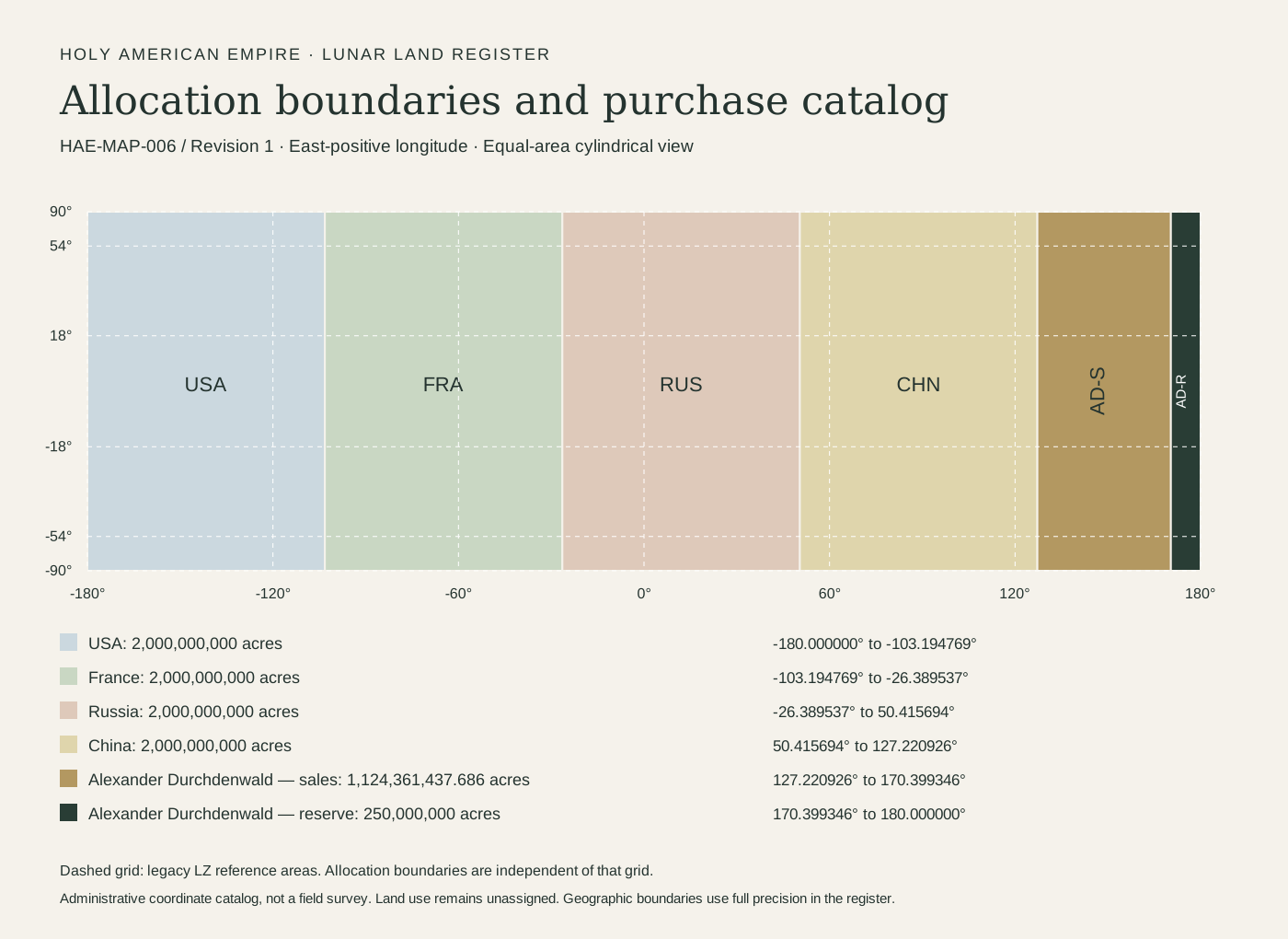
| Allocation | Acres | Longitude boundaries | Catalog treatment |
|---|
All allocation bands extend from 90° N to 90° S. Longitude is east-positive. Shared boundaries belong to the band on their eastern side; the 180° seam closes the globe. Full-precision coordinates are retained in the register.
Each parcel contains one acre. Select adjacent parcels within the same row for a larger request.
Loading catalog and recorded status…
Use the identical parcel reference for HAE-LUN-023 (reservation), HAE-LUN-024 (parcel record), and HAE-LUN-026 (transfer). The catalog does not treat submitting a form as a recorded sale.
USA, France, Russia, and China allocations accept sale-record submissions separately. They are not listed as Alexander’s sale parcels.
Coordinate model: lunar planetocentric latitude and east-positive longitude; equal-area cells on a mean sphere normalized to NASA’s 37,936,694.79 km² surface area. Acre = 4,046.8564224 m². Shapes vary with latitude. LZ-01 through LZ-30 remain geographic index references, not parcel identifiers or permissions. Legacy land-use colors do not govern this catalog.